Cs:Key:natural
 |
| Popis |
|---|
| Používáno pro zakreslení přírodních objektů a vlastností krajiny, včetně těch, které byly pozměněny člověkem. |
| Skupina: Přírodní |
| Použité na těchto prvcích |
| Popsané hodnoty: 37 |
| Status: de facto |
| Nástroje |
Použití
- Viz také: Přírodní
Používáno pro zakreslení některých geologických vlastností a pokryvu půdy.
Hodnoty
V tabulce níže jsou často používané hodnoty:
| Klíč | Hodnota | Prvek | Popis | Tag Usage[1] | Vykreslování | Ilustrace |
|---|---|---|---|---|---|---|
Související s vegetací nebo povrchem | ||||||
| natural | fell | No, see #545. | 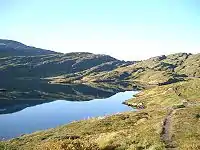 | |||
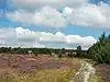
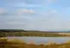
| natural | grassland |  |
 | |||
| natural | heath |  |
 | |||
| natural | moor | momentálně Mapnikem nevykreslováno | 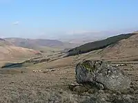 | |||
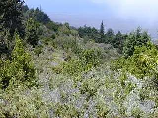
| natural | scrub |  |
 | |||
| natural | shrubbery | An area of shrubbery that is actively maintained or pruned by humans. A slightly wilder look is also possible | currently not rendered by openstreetmap-carto | 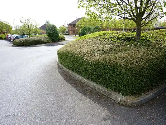 | ||
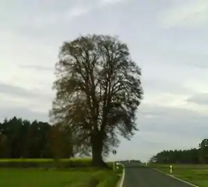
| natural | tree | Solitérní nebo význačné Můžete ho popsat blíže značkami height=*, circumference=*, start_date=*, denotation=* |
 | |||
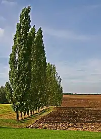
| natural | tree_row |  |
 | |||
| natural | tree_stump | A tree stump, the remains of a cut down or broken tree. | 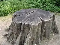 | |||
| natural | tundra | Habitat above tree line in alpine and subpolar regions, principally covered with uncultivated grass, low growing shrubs and mosses and sometimes grazed. | 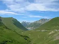 | |||
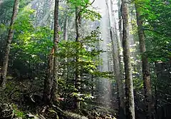
| natural | wood | Značkou leaf_type=* (nahradila zastaralou značku wood=*) můžete blíže popsat typ lesa:
|
 |
| ||
Související s vodou | ||||||
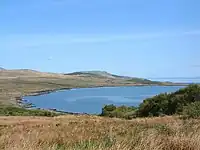
| natural | bay |  |
 | |||
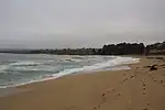
| natural | beach |  |
 | |||
| natural | blowhole | An opening to a sea cave which has grown landwards resulting in blasts of water from the opening due to the wave action | 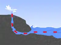 | |||
| natural | cape | 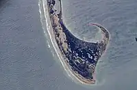 | ||||
| natural | coastline | 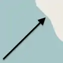 |
 | |||
| natural | crevasse | A large crack in a glacier | 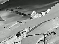 | |||
| natural | geyser | 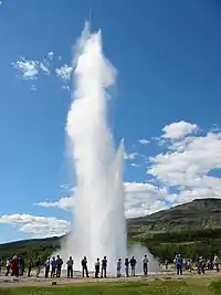 | ||||
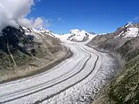
| natural | glacier |  |
 | |||
| natural | hot_spring | 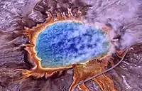 | ||||
| natural | isthmus | A narrow strip of land, bordered by water on both sides and connecting two larger land masses. | 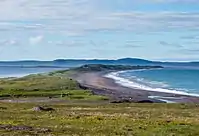 | |||
| natural | mud |  |
 | |||
| natural | peninsula | A piece of land projecting into water from a larger land mass, nearly surrounded by water | ||||
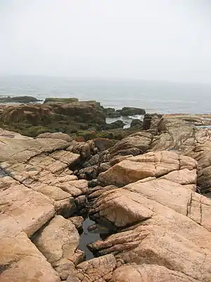
| natural | reef | A feature (rock, sandbar, coral, etc) lying beneath the surface of the water | 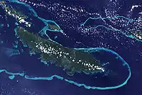 | |||
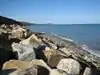
| natural | shingle | Nahromaděné vodou erodované kameny, obvykle oblázky a štěrk, někdy i větší. |  |
 | ||
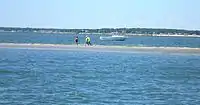
| natural | shoal | An area of the sea floor near the sea surface (literally, becomes shallow) and exposed at low tide. See natural=sand as well. | |
 | ||
| natural | spring | 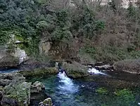 | ||||
| natural | strait | A narrow area of water surrounded by land on two sides and by water on two other sides. | 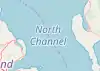 |
.jpg.webp) | ||
| natural | water |  |
 | |||
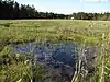
| natural | wetland |  |
 | |||
Související s tvarem krajiny | ||||||
| natural | arch | A rock arch naturally formed by erosion, with an opening underneath. | currently not rendered by openstreetmap-carto | 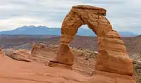 | ||
| natural | arete | momentálně Mapnikem nevykreslováno | 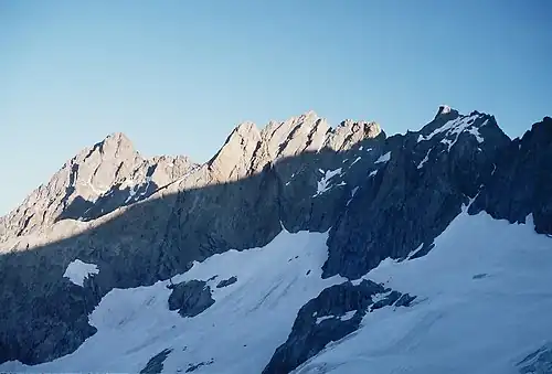 | |||
| natural | bare_rock |  |
 | |||
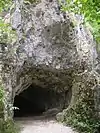
| natural | cave_entrance | Vstup do přírodní Můžete doplnit, zda je vchod nějak zabezpečen barrier=*, zda se platí vstupné fee=* a jaké jsou otevírací hodiny opening_hours=*. |
Uzel: |
 | ||
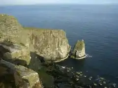
| natural | cliff | Sráz, skalní stěna, útes. Vršek je nalevo od směru zakreslované cesty. |  |
 | ||
| natural | dune | A hill of sand formed by wind, covered with no or very little vegetation. See also natural=sand and natural=beach | currently not rendered by openstreetmap-carto | 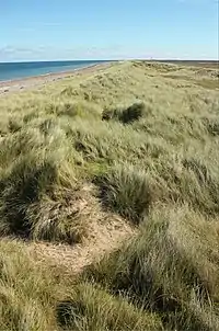 | ||
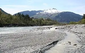
| natural | earth_bank | Large erosion gully or steep earth bank | _1.jpg.webp) | |||
| natural | fumarole | A fumarole is an opening in a planet's crust, which emits steam and gases | .jpg.webp) | |||
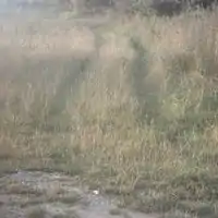
| natural | gully | Small scale cut in relief created by water erosion | 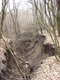 | |||
| natural | hill | A hill. | currently not rendered by openstreetmap-carto | 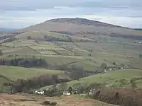 | ||
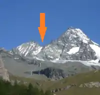
| natural | peak | 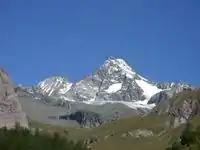 | ||||
| natural | ridge | momentálně Mapnikem nevykreslováno | 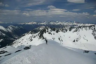 | |||
| natural | rock | Volně stojící kámen/balvan je natural=stone. |
momentálně Mapnikem nevykreslováno | 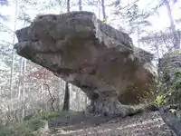 | ||
| natural | saddle | Prochází-li průsmykem silnice, je vhodné její nejvyšší bod označit mountain_pass=*. |
 | |||
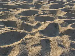
| natural | sand |  |
 | |||
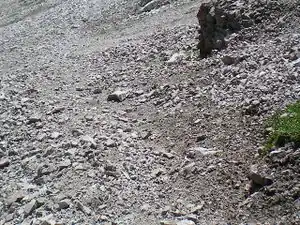
| natural | scree | |
 | |||
| natural | sinkhole | momentálně Mapnikem nevykreslováno | 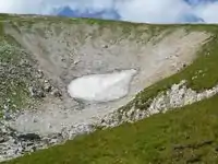 | |||
| natural | stone | Volně stojící přírodní kámen. Například Není to velký kámen/skála (natural=rock), ani historický kámen opracovaný člověkem (historic=stone). Můžete přidat jeho výšku a šířku značkami height=*, width=*. |
momentálně Mapnikem nevykreslováno | 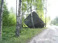 | ||
| natural | valley | Údolí | momentálně Mapnikem nevykreslováno | 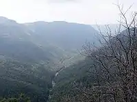 | ||
| natural | volcano | 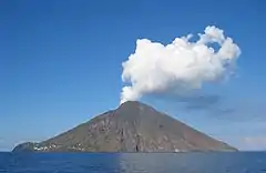 | ||||
| natural | user defined | Další často používané hodnoty najdete pomocí Taginfo. | ||||
This table is a wiki template with a default description in English. Editable here.
- ↑ Does not include uses in semi-colon value separated lists
This article is issued from Openstreetmap. The text is licensed under Creative Commons - Attribution - Sharealike. Additional terms may apply for the media files.